Published January 11, 2018 05:11AM
Natural high: Your guide to road cycling in Victoria's High Country
Offering some of the best riding in the land, Victoria's High Country is a cyclist's paradise. We recently ventured to the region for a four-day adventure that introduced us to the very best of the North East – quiet valley roads, fantastic food, wine and beer, and mountains. Lots and lots of mountains.
NATURAL HIGH
YOUR GUIDE TO ROAD CYCLING IN VICTORIA’S HIGH COUNTRY
This content is brought to you by Ride High Country and Louis Garneau.
Find out more about our sponsored content policies here.
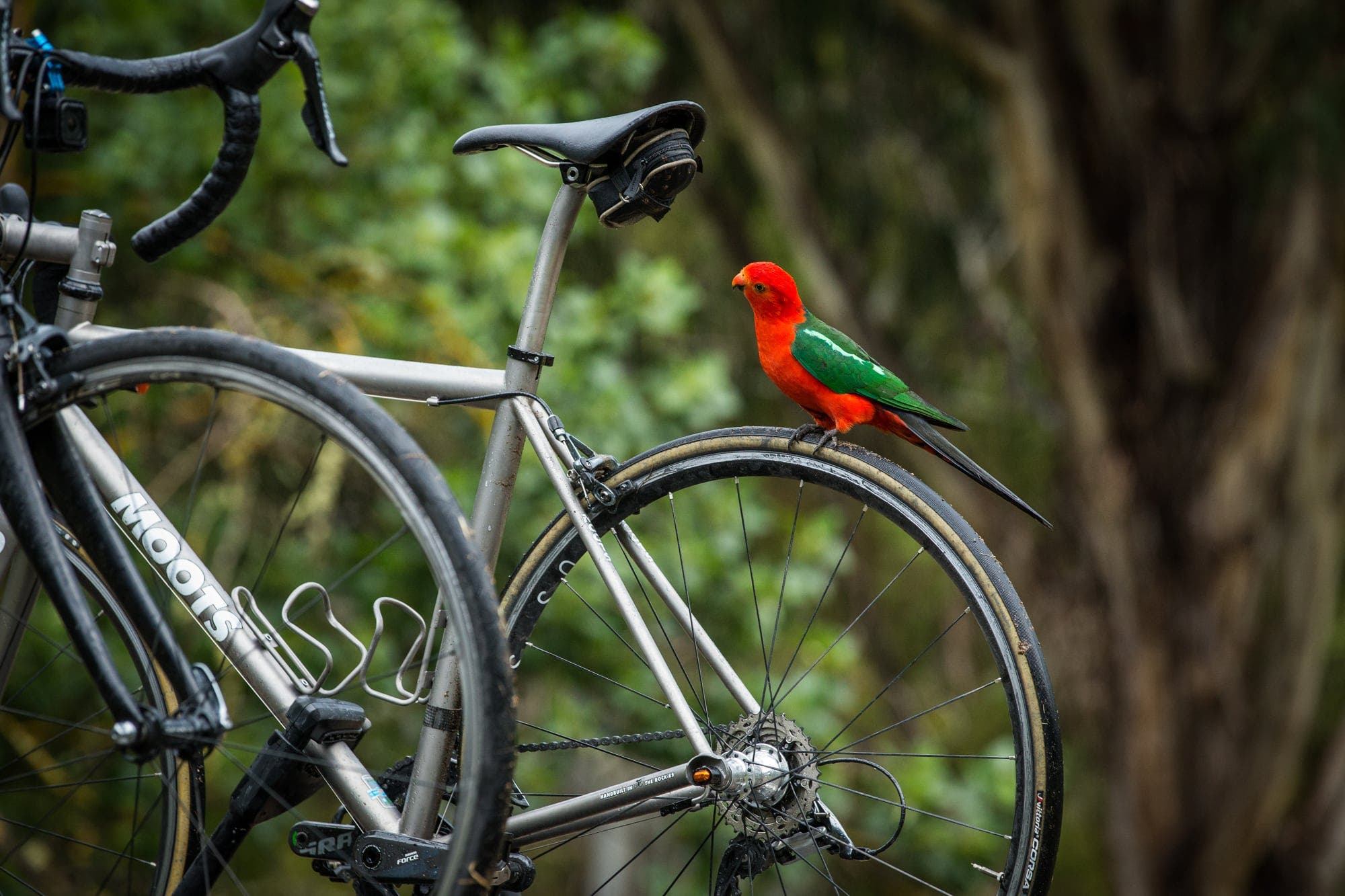
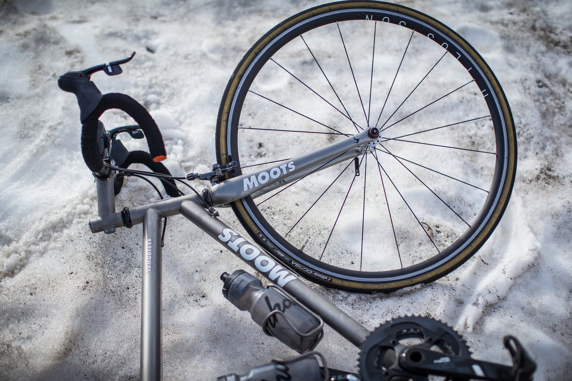
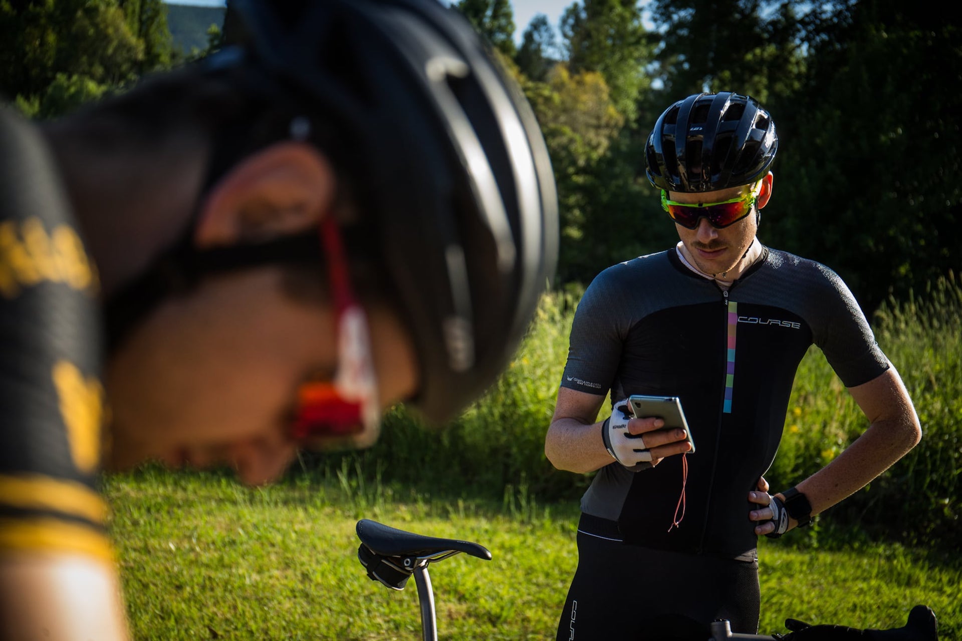
Text: Matt de Neef | Photography: Tim Bardsley-Smith | Production: Iain Treloar
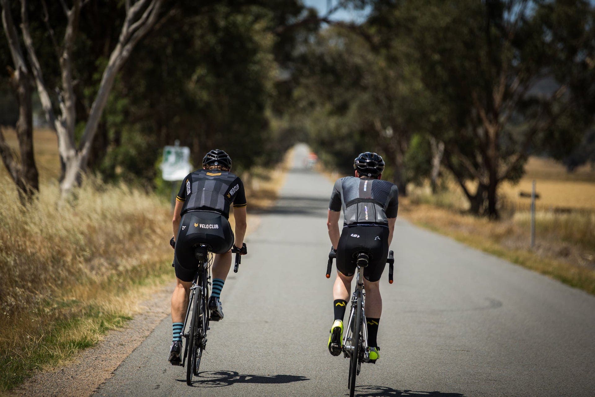
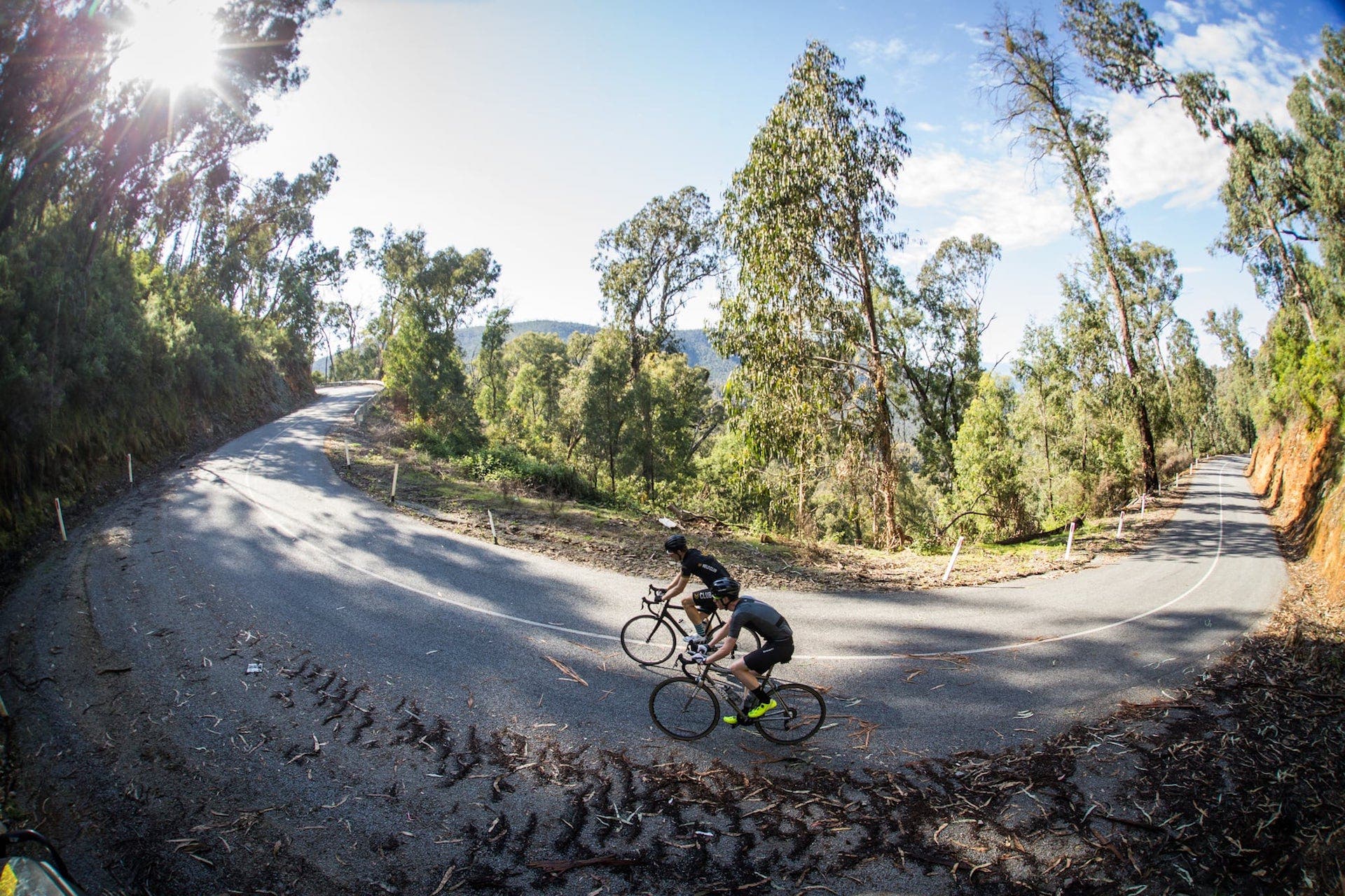
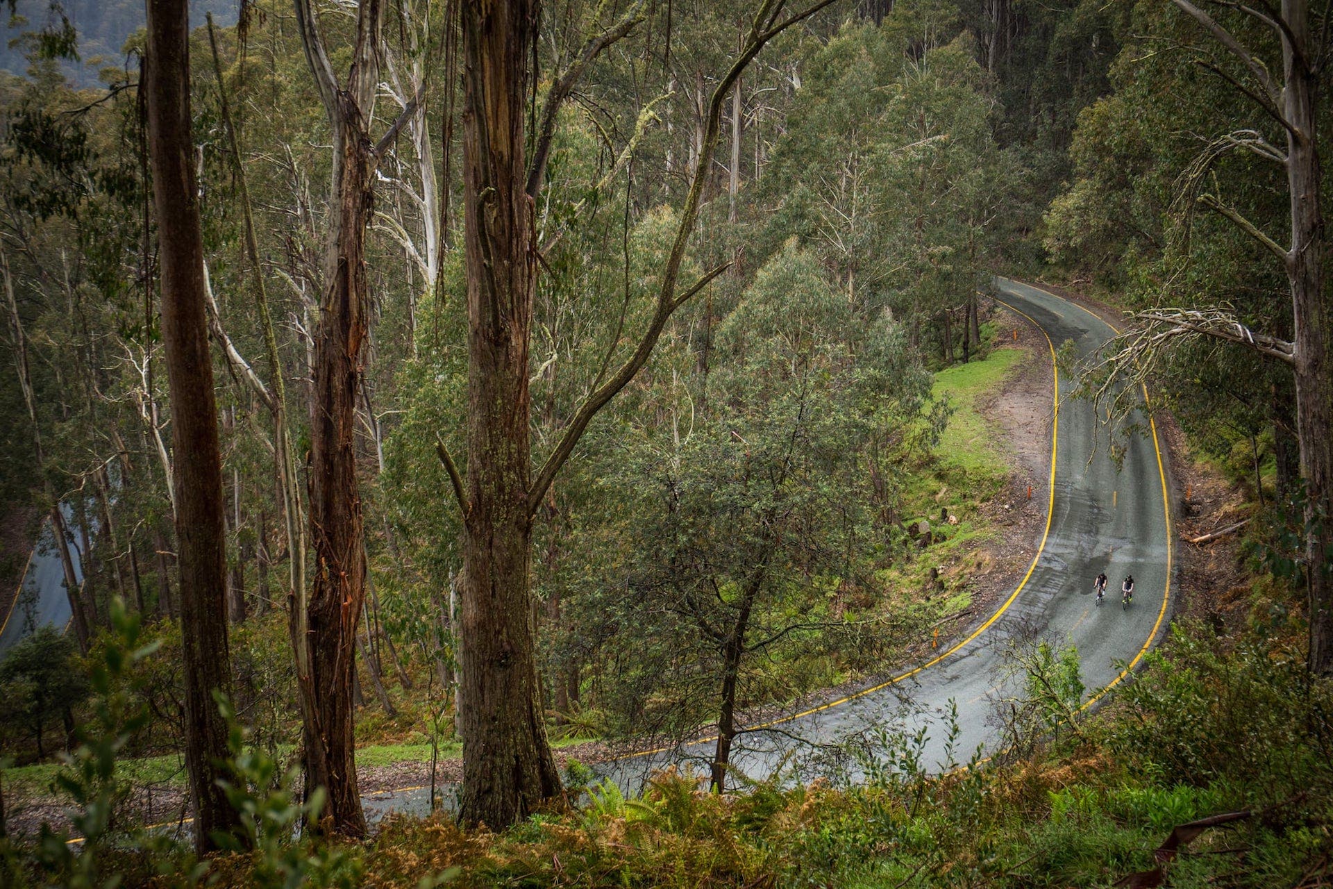
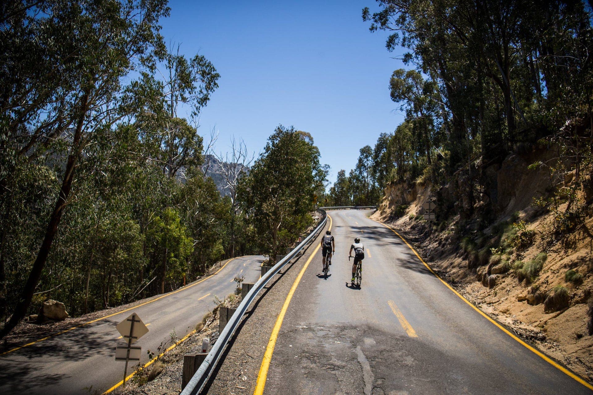
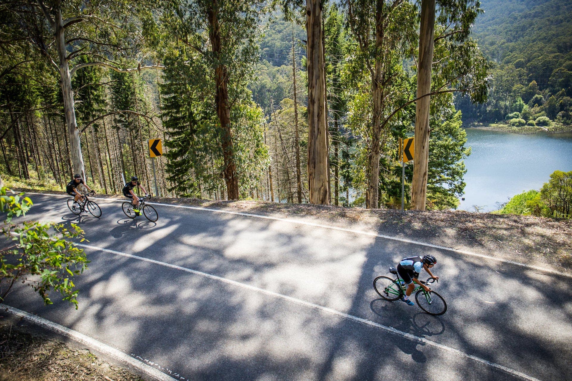
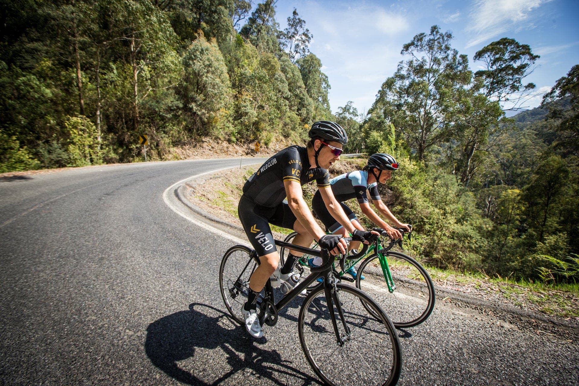
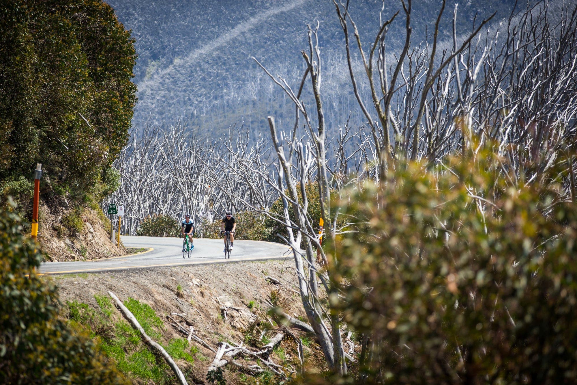
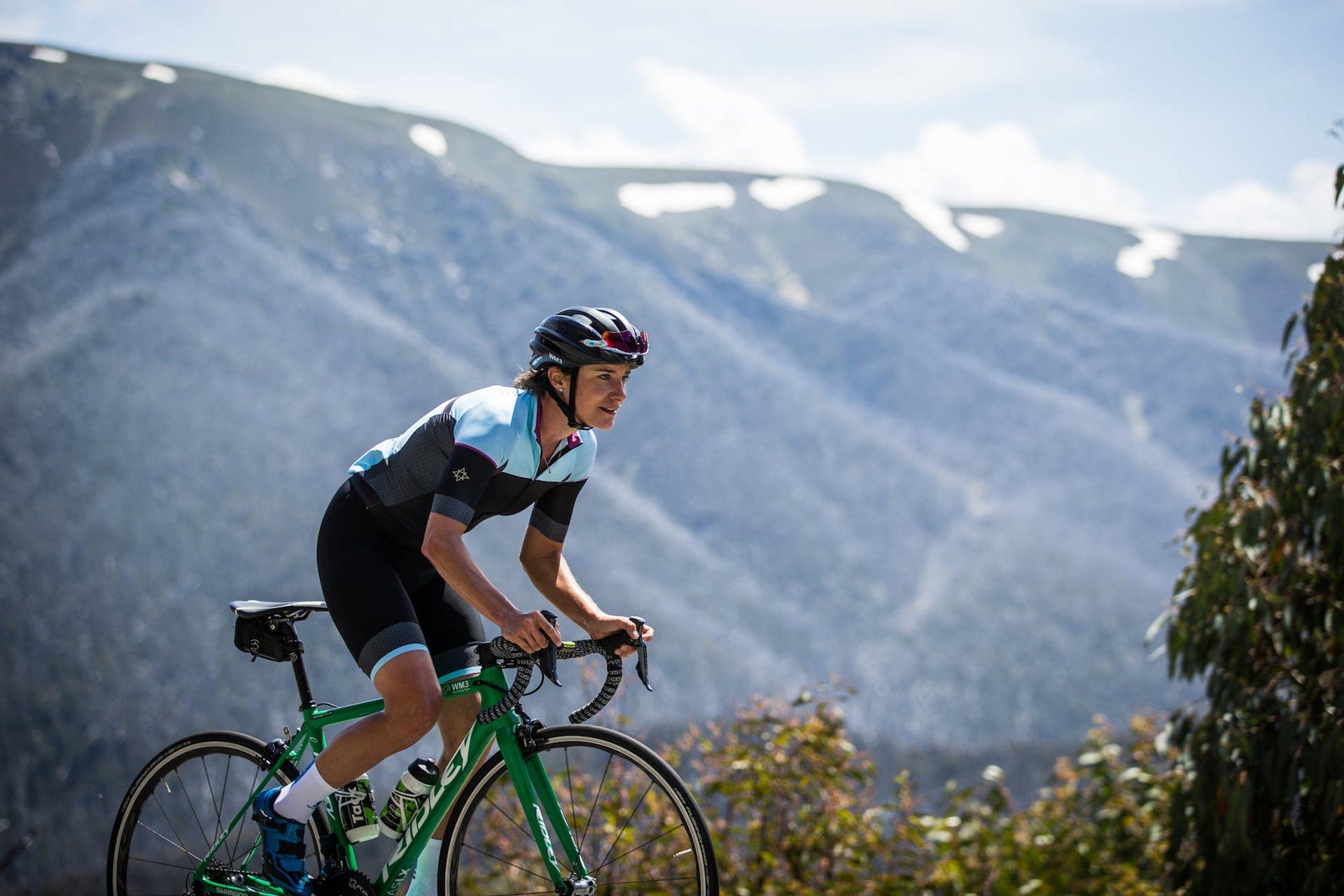
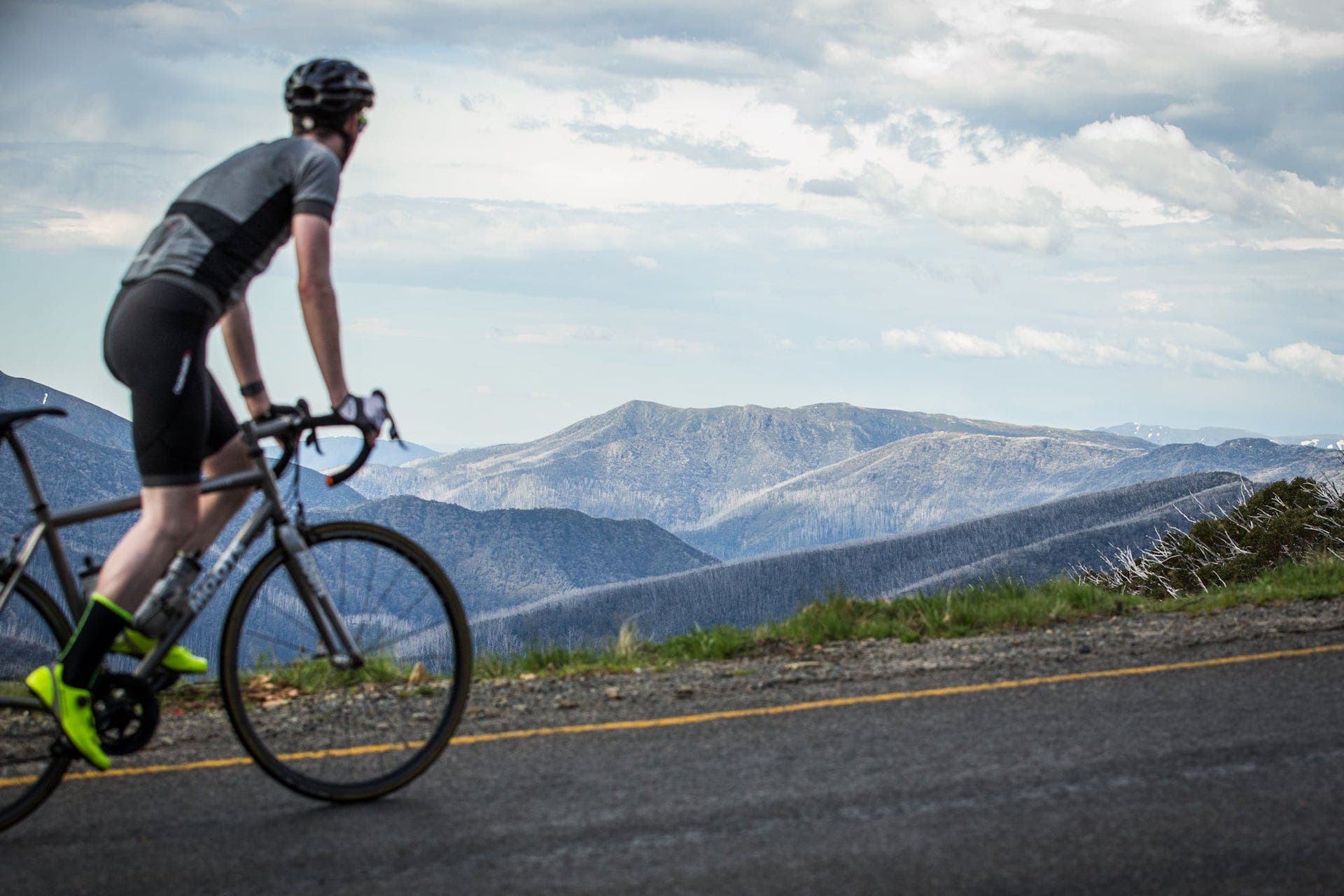
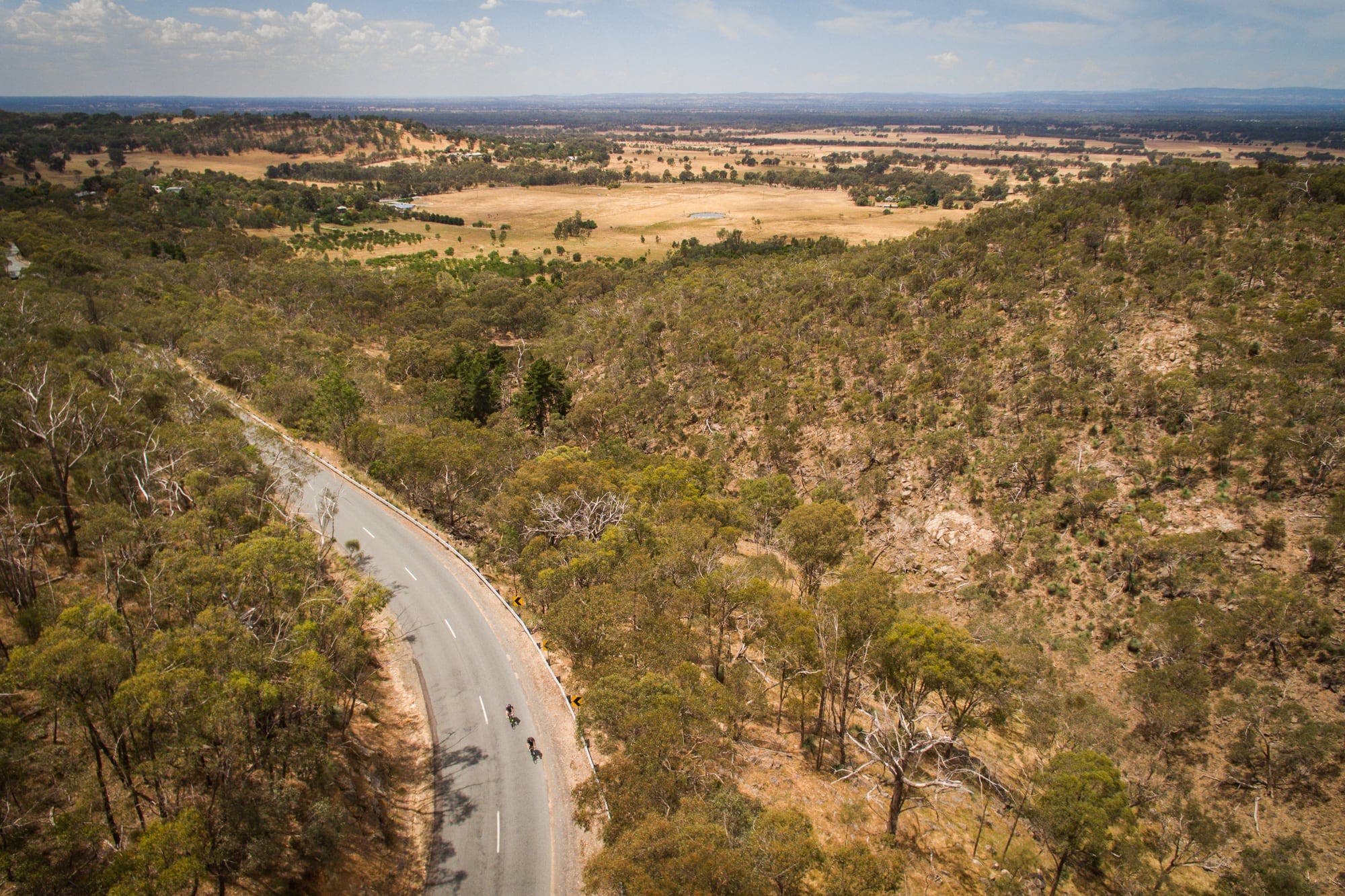
There are few road cycling destinations in Australia with as much to offer as Victoria’s High Country. Located in the north east pocket of the state, the High Country is best known among cyclists for its long, challenging road climbs. But besides offering some of the best training anywhere in the country, these mountains also play host to some thrilling descents and some spectacular views.
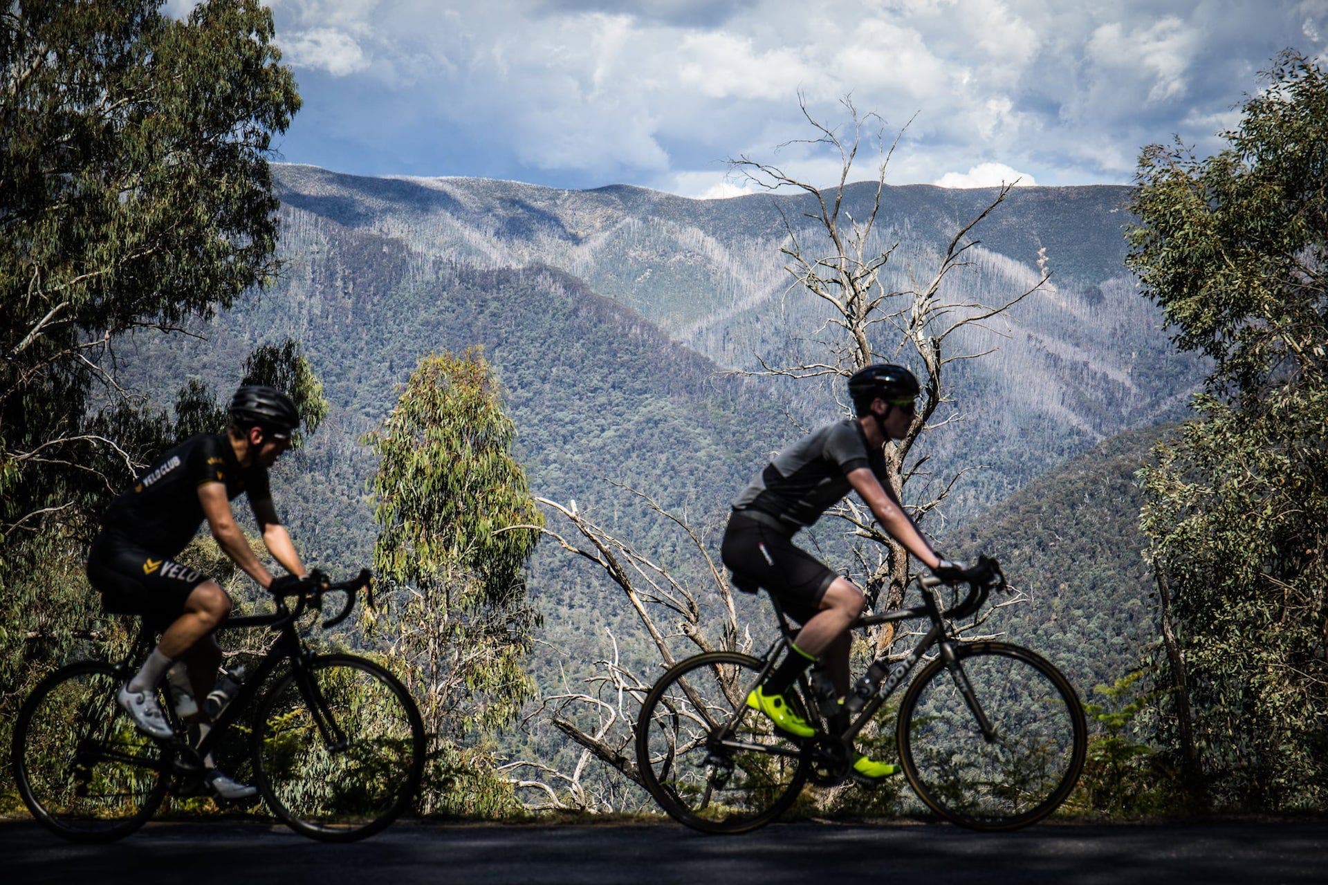
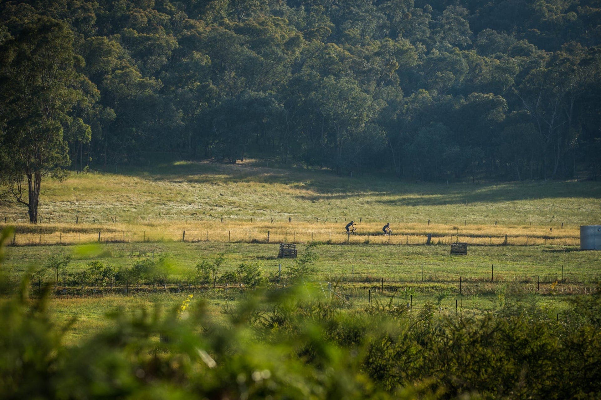
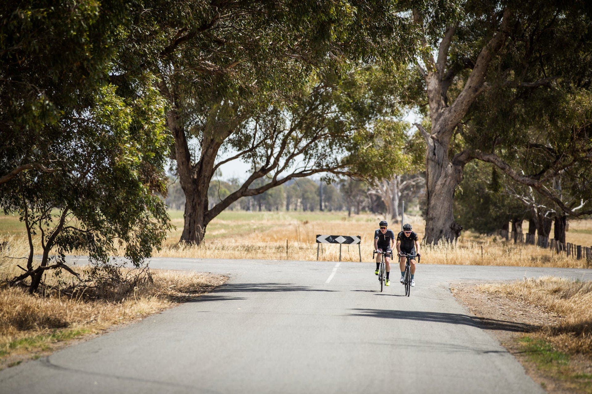
There’s more to riding in Victoria’s High Country than spectacular mountain climbs, though. Beautiful quiet country roads criss-cross the region, linking lakes, valleys and farmlands to the region’s many small towns. Rail trails thread through the valleys, the abandoned rail corridors having been turned into valuable infrastructure for riders of all ages.
And as good as the cycling is in the “Victorian Alps”, the region shines just as brightly when you’re off the bike. In addition to popular towns like Bright and Beechworth, the region is famed for its terrific local produce, international quality wine and burgeoning craft beer scene.
ADVERTISEMENT
Victoria’s High Country
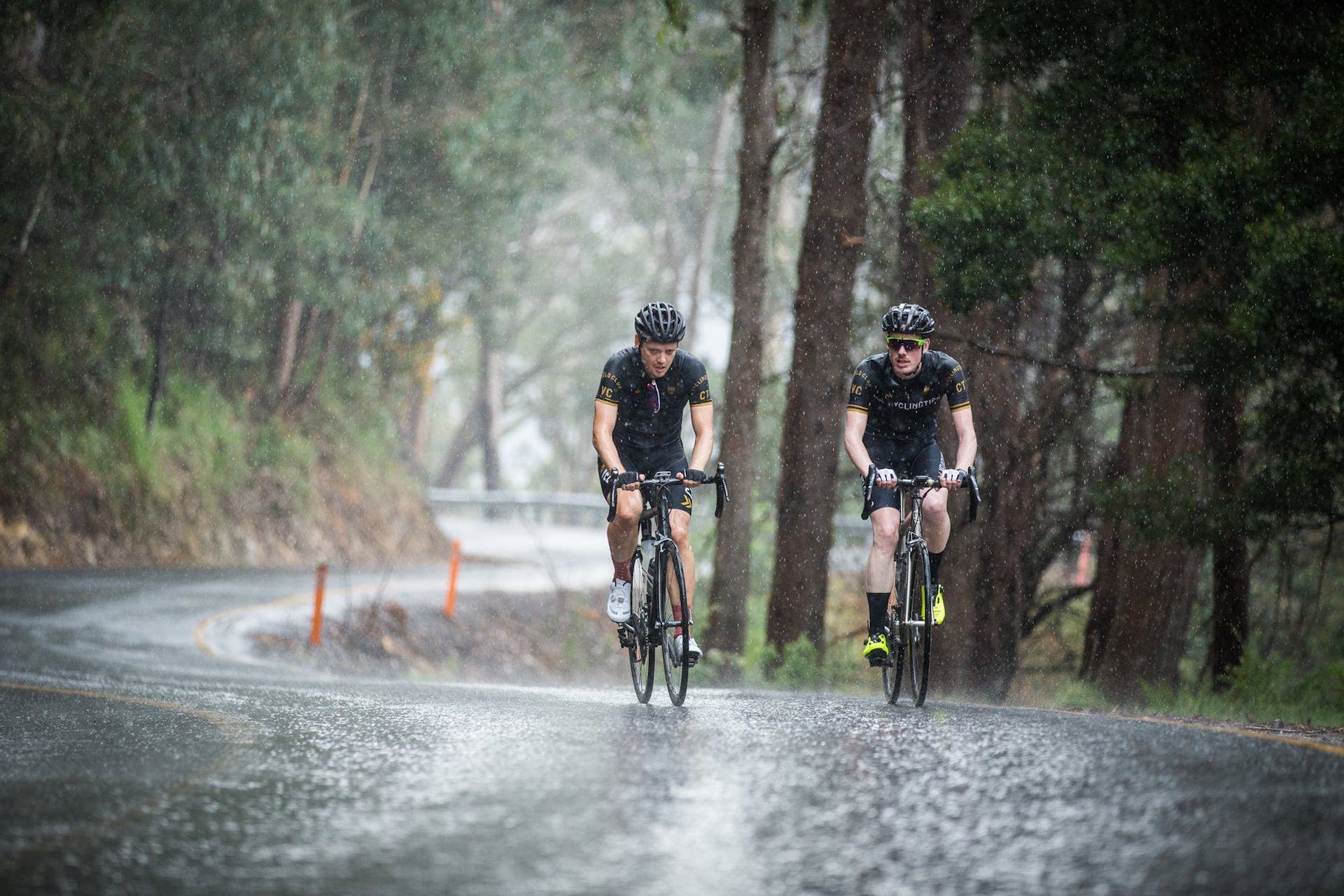
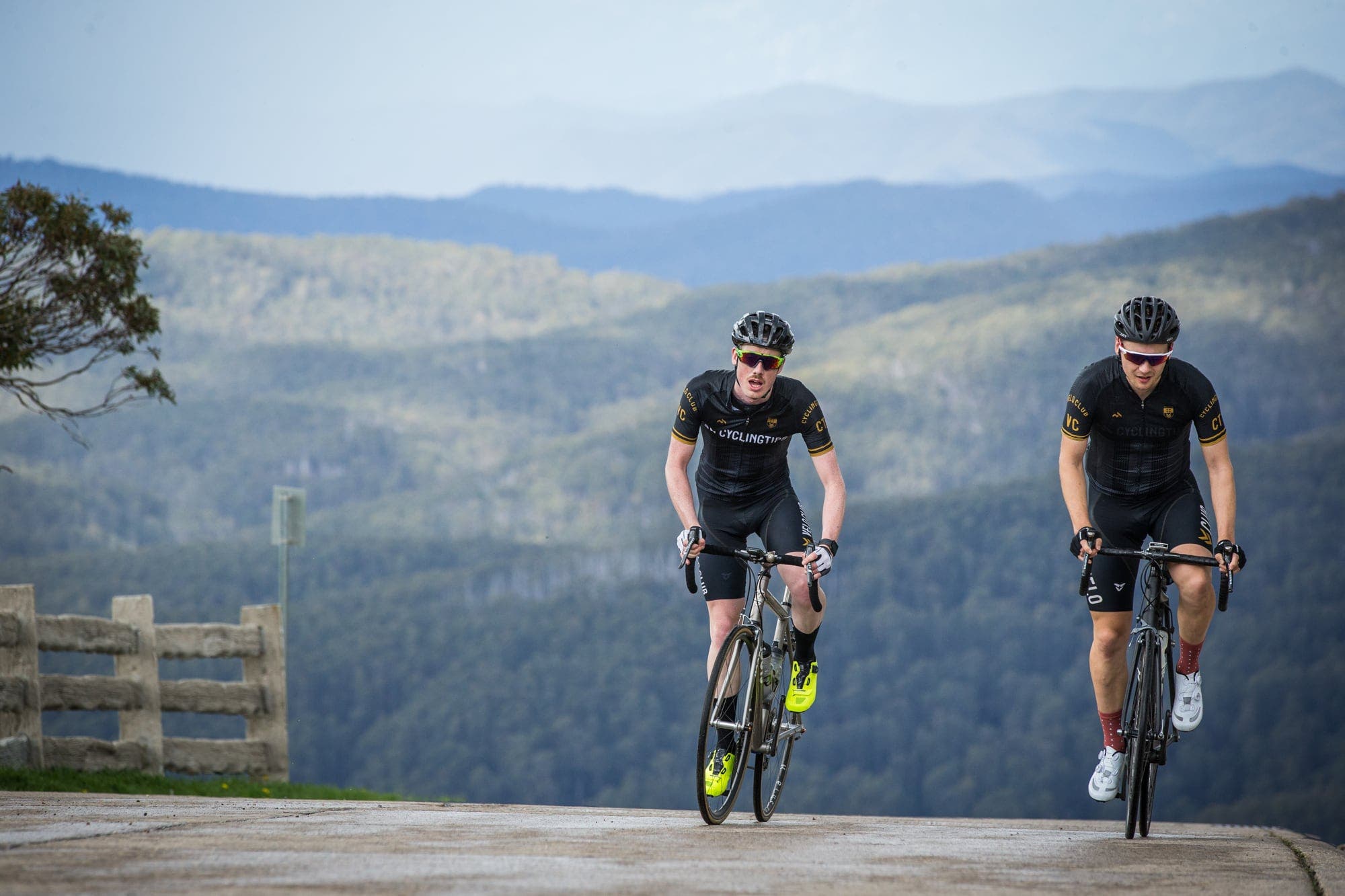
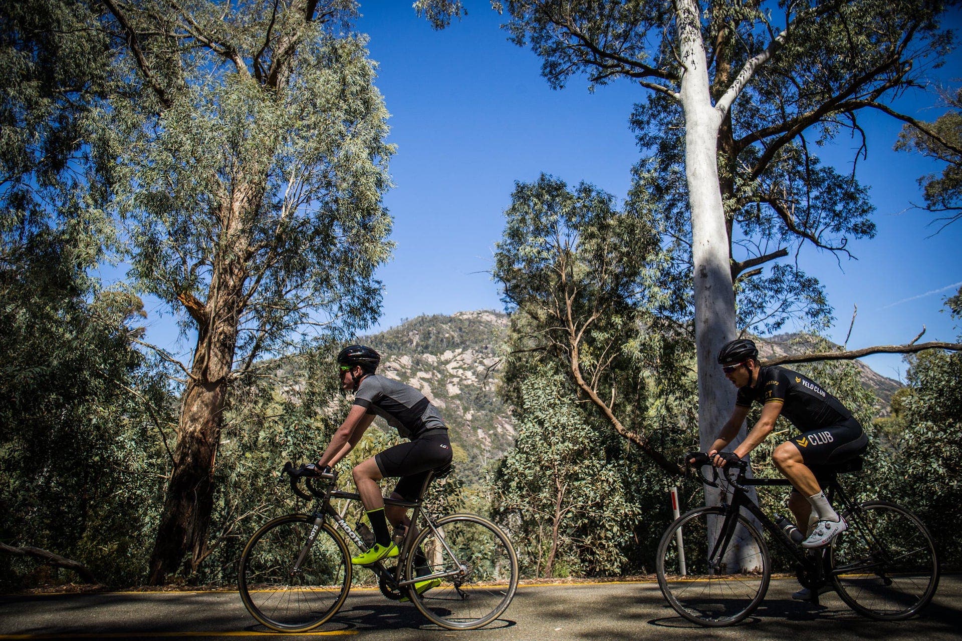
In late November CyclingTips ventured to Victoria’s High Country for a four-day adventure that introduced us to the best that the region had to offer, both on the bike and off. We rolled along picturesque valley roads, climbed mountains (including one with a world champion), rode the wide streets of gold rush-era towns, got caught in thunderstorms, ate some sensational food and enjoyed many a frosty beverage at the end of a day’s riding.
Here’s how it unfolded:
If you’re planning your own trip to the High Country, scroll down for our guide to the best riding, accommodation and food and drink in the region – or visit Ride High Country’s webpage here.
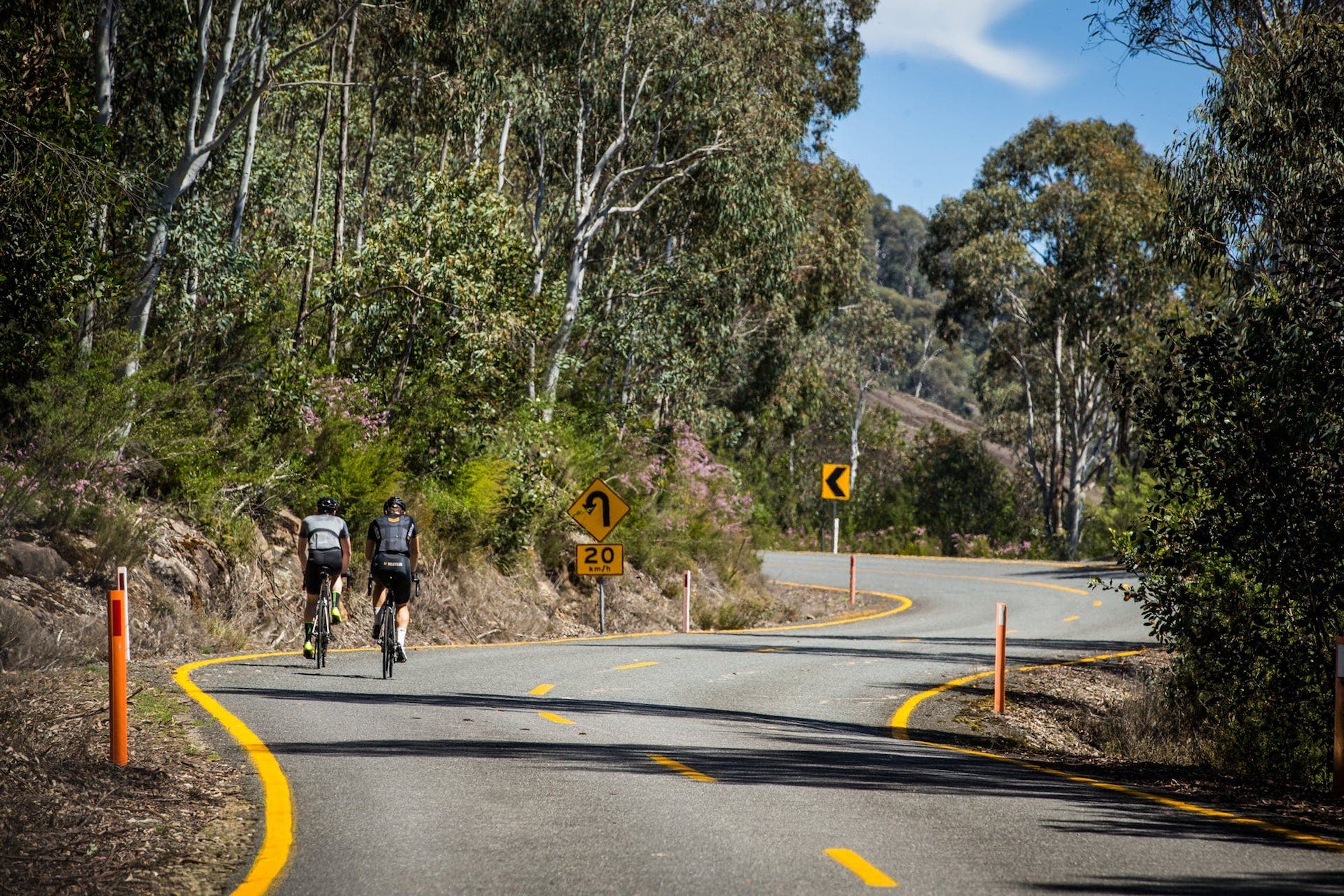
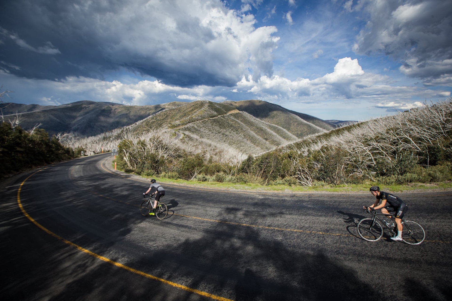
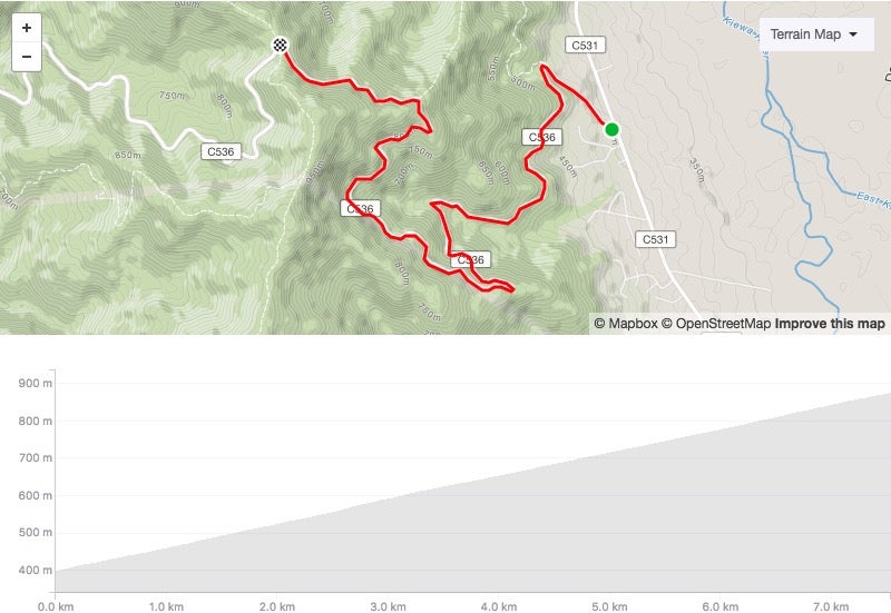
It’s no surprise that Victoria’s High Country is best known for its long mountain climbs. It is the “High Country” after all. And when it comes to doing long climbs in the region, the intrepid cyclist has many to choose from.
7 Peaks is an initiative from Ride High Country that challenges cyclists to climb seven of the state’s biggest mountains, including Mt. Buffalo, Mt. Buller, Falls Creek, Mt. Hotham and Dinner Plain. And these aren’t the only big climbs in the area …
Here’s what you need to know about the High Country’s biggest climbs:
ADVERTISEMENT
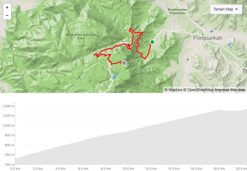
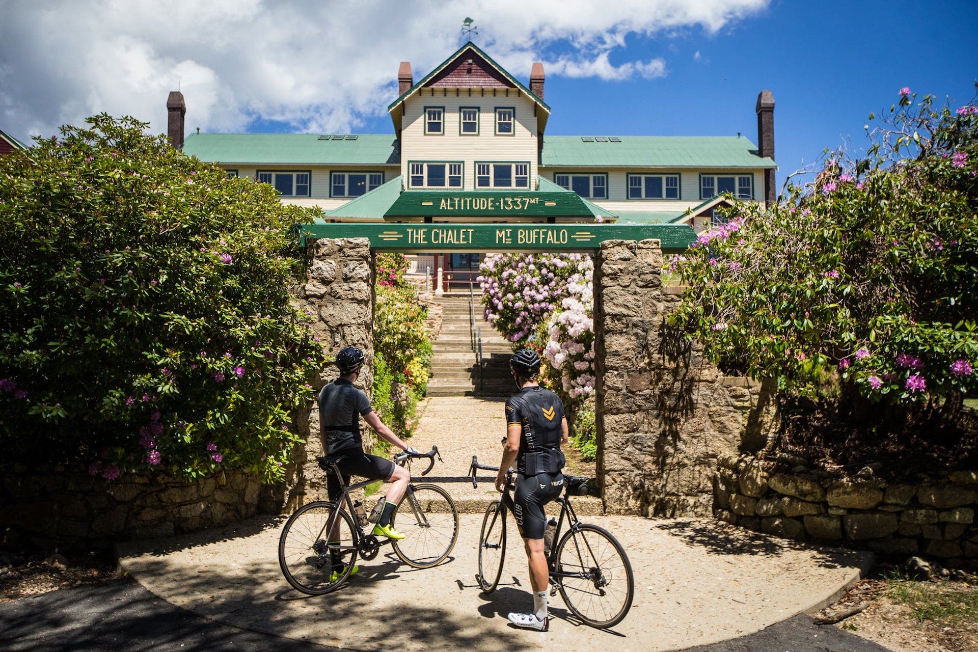
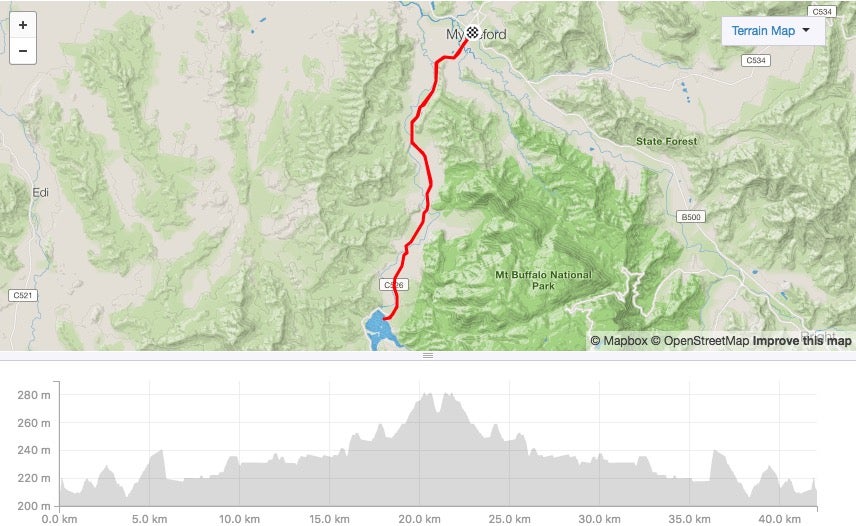
Mt. Buffalo – From Bright
Start: National Park entrance
Length: 20.4km
Average gradient: 5%
Strava: here
A wonderfully scenic (and very consistent) ascent of 18km that takes you to a plateau where you’ll have several options before you finish. Go left for a couple kilometres to the old Mt. Buffalo Chalet (the “official” end of the climb); carry straight on for 4km to the shop at Dingo Dell; or continue on past Dingo Dell for another 7km (much of it on gravel) to get to The Horn — the end of the road. Be sure to enjoy yourself (safely) on the way down — we’d argue it’s the best descent in the state!
ADVERTISEMENT
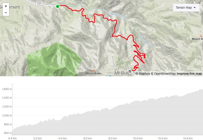
Mt. Buller – From Mirimbah
Start: Mirimbah
Length: 15.2km
Average gradient: 6%
Strava: here
This is a mostly steady climb out of Mirimbah with a few flatter sections and a tough 1.5km section to the Mt. Buller village. The “official” climb might finish at the T-intersection, but turn right and ride up to the Arlberg Hotel (where the road turns to rough gravel) to conquer the full climb!
Start and finish in Mansfield for a challenging ride of nearly 100km.
[et_pb_ctips_dfp_dynamic_ad_unit _builder_version=”3.0.93″ ad_unit_desktop=”Content_Pages_Billboard_1024x250″ ad_unit_mobile=”none” ad_unit_targeting=”ARTICLE:TOURISMNE” /]
ADVERTISEMENT
MOUNT BULLER
MOUNT BUFFALO
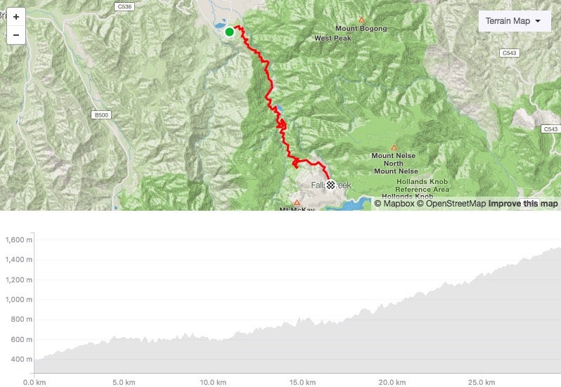
Falls Creek – From Mt. Beauty
Start: Mt. Beauty
Length: 29.4km
Average gradient: 4%
Strava: here
A long and varied climb that can be broken into several distinct sections. The first 4km climb steadily, the next 13km are undulating and feature a couple of descents; the final 13km stretch is the toughest, the last 4km from the tollbooth in particular.
ADVERTISEMENT
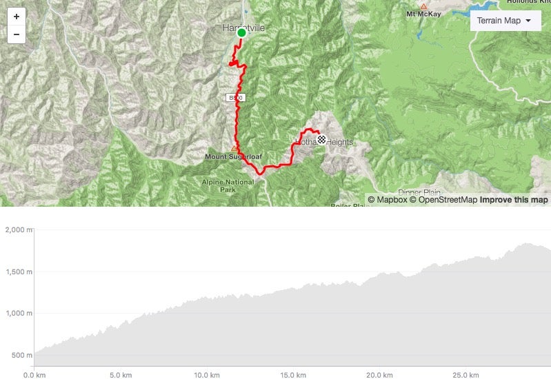
Mt. Hotham
Start: Harrietville
Length: 30km
Average gradient: 4%
Strava: here
Perhaps the most intimidating of all the High Country climbs, Mt. Hotham is a challenge for riders of all abilities. The first 10km out of Harrietville provide a tough introduction; the next 9km are much flatter but still tend upwards; and the final 10km — all above the treeline — are seriously challenging.
There are a couple of short descents in this final section, but the steep sections in between (CRB Hill and Diamantina especially) make this a true test of strength and resolve.
ADVERTISEMENT
FALLS CREEK
MOUNT HOTHAM
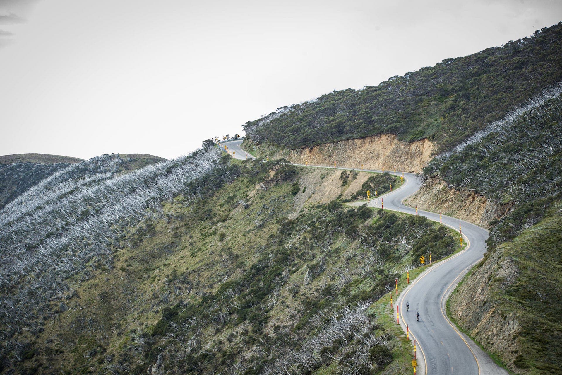
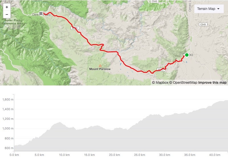
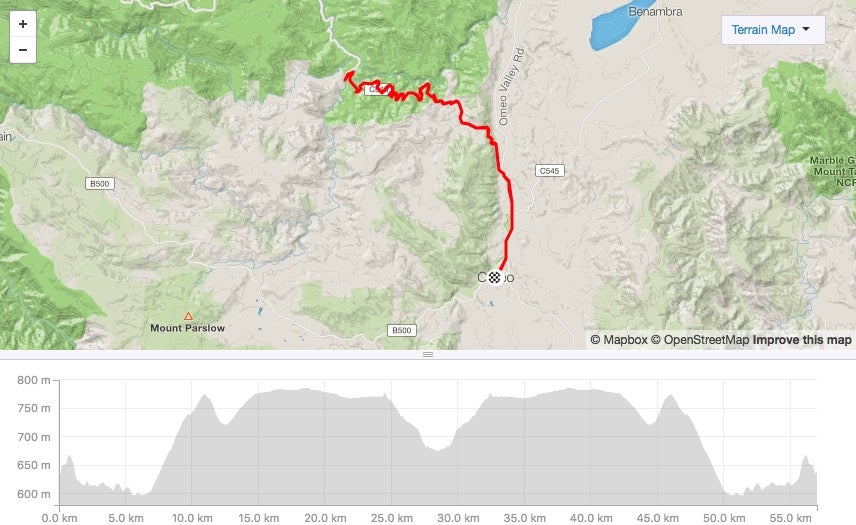
Dinner Plain
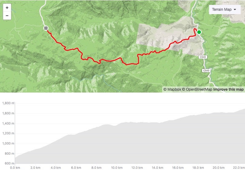
Start: Omeo
Length: 42.6km
Average gradient: 2%
Strava: here
At 42km, this is the longest mountain climb in the High Country. It’s not uphill the whole way; rather it’s two main sections of climbing — one after 2km, the other after 22km — that provide most of the challenge. Be sure to take enough food and water with you — this is a long and challenging climb in a remote part of the region.
Note: This climb is essentially the backside of Mt. Hotham. Extend your ride by an undulating 11km from Dinner Plain and you’ll reach the Mt. Hotham village.
ADVERTISEMENT
Back of Falls – from Angler’s Rest
Start: WTF Corner (11km north of Angler’s Rest)
Length: 22.6km
Average gradient: 4%
Strava: here
This climb isn’t part of the 7 Peaks, but it is every bit as challenging as the other ascents. From the ridiculously steep opening (lovingly referred to as WTF Corner), it’s 9km at close to 9% — a tough slog. From there the gradient becomes more manageable but it’s still another 14km or so to Raspberry Hill, where the road starts to tend downwards to the Falls Creek resort.

ADVERTISEMENT
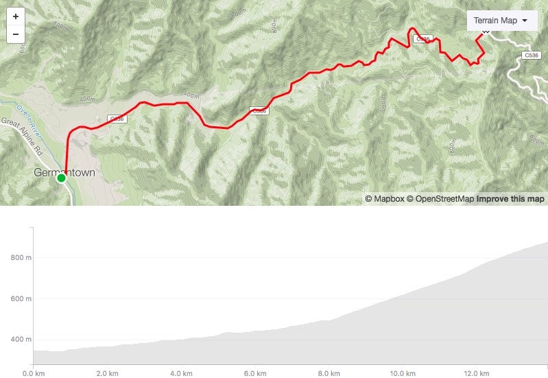
Tawonga Gap (Bright side)
Start: Germantown
Length: 13.9km
Average gradient: 4%
Strava: here
Of the two sides of Tawonga Gap, this ascent is the longer but perhaps the easier. The climbing starts very gently to begin with, then gets more challenging in the final kilometres before the summit. Be sure to enjoy the great views at the top before heading down (either the way you came, or over the other side to Mt. Beauty).
ADVERTISEMENT
Tawonga Gap (Mt. Beauty side)
Start: Tawonga South
Length: 7.5km
Average gradient: 6%
Strava: here
Where the Bright side of Tawonga Gap starts gently, the climb out of Mt. Beauty is tough from the start and stays that way throughout. In recent years this ascent has played host to the summit finish to stage 2 of the Tour of Bright. It’s a challenging little climb and one that will bite back if you set out too hard.
Of course, there’s plenty more riding in the High Country beyond the big climbs. There are any number of loops throughout the region that allow you to experience the beauty of Victoria’s High Country without having to retrace your steps.
Here’s a selection:
ADVERTISEMENT
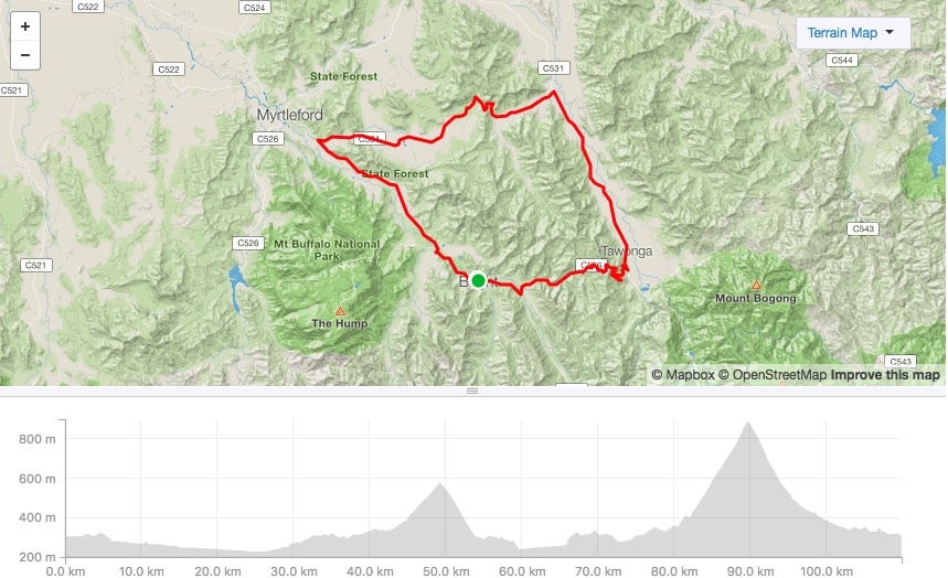
“The Gaps Loop”
Start/finish: Bright
Length: 110km
Terrain: Hilly
Strava: here
A challenging loop featuring two climbs. The Rosewhite Gap climb (4.3km at 4%) comes after 43km, while the Tawonga Gap (Mt. Beauty side) climb starts after 82km. This loop is used as the basis for stage 2 of the Tour of Bright, one of Australia’s most well-loved amateur stage races (although the stage now ends at the top of Tawonga Gap rather than in Bright).
ADVERTISEMENT
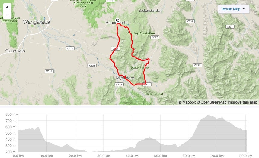
Beechworth-Stanley loop
Start/finish: Beechworth
Length: 80km
Terrain: Hilly
Strava: here
A hilly loop featuring some beautiful country roads, the Murray to Mountains Rail Trail (see below), some wonderful gold-rush era towns, and the tough Myrtleford-Stanley Road climb quite close to the end. This 10km ascent featured in the 2017 Jayco Herald Sun Tour and features a 3km section at roughly 10%. A tough challenge before the lovely roll through Stanley then back into Beechworth.
ADVERTISEMENT
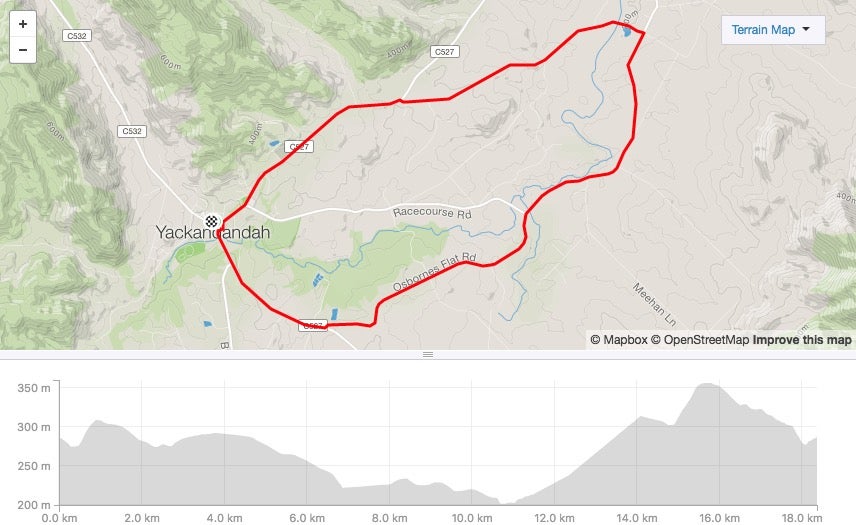
Osborn’s Flat loop
Start/finish: Yackandandah
Length: 18km
Terrain: Largely flat
Strava: here
A short ride that starts in the gold rush town of Yackandandah and includes some lovely quiet country roads. Save something in your legs for the punchy climb that comes after 11km.
ADVERTISEMENT
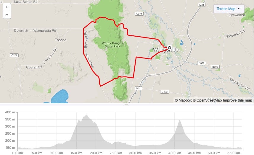
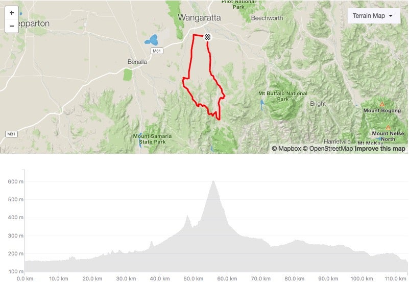
Wangaratta – Taminick Gap loop
Start/finish: Wangaratta
Length: 57km
Terrain: Largely flat with two climbs
Strava: here
This loop heads counter-clockwise out of Wangaratta and is largely flat, apart from two climbs over the Warby Ranges. The first climb (4.2km at 4.1%) comes after 13km, while the second — back over the Taminick Gap towards “Wang” — is 3.1km at 5% and comes after 38km.
ADVERTISEMENT
“Strade Nero” loop
Start/finish: Oxley
Length: 114km
Terrain: Hilly
Strava: here
The “Strade Nero” loop is a challenging circuit south of Wangaratta that’s used in the Sam Miranda Tour of the King Valley. Its name comes from the hilly gravel roads that define this loop, but don’t worry — this loop is more than rideable on good, 25mm road bike tyres.
The ride heads counterclockwise and heads into the hills near Whitfield roughly halfway through. There’s plenty of climbing in that middle section of the loop but then it flattens off on the way back up towards Oxley.
ADVERTISEMENT
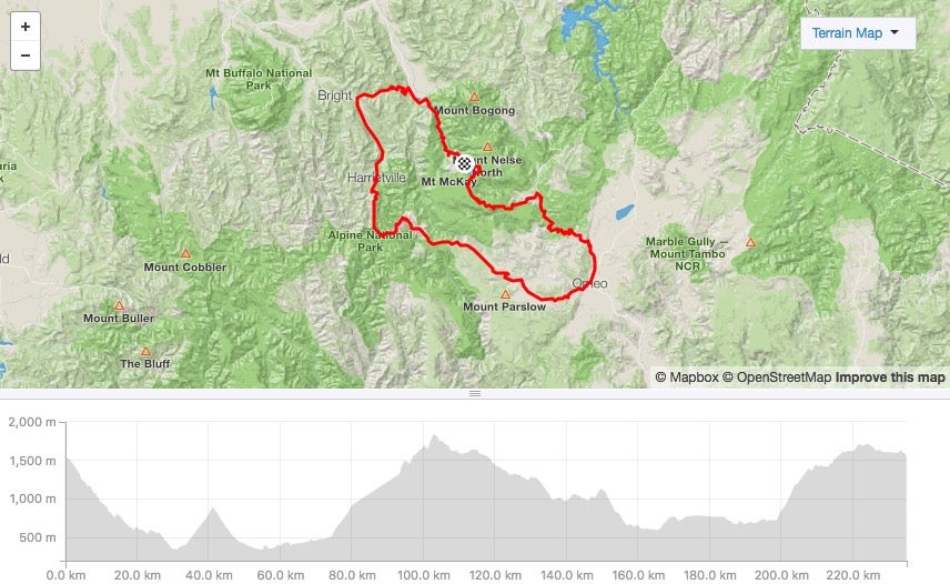
Peaks Challenge loop
Start/finish: Falls Creek
Length: 235km
Terrain: Mountainous
Strava: here
Probably the hardest single-day loop in the High Country, this full-day ride features three significant climbs: Tawonga Gap (Mt. Beauty side), Mt. Hotham and the Back of Falls. This loop is the stage for Bicycle Network’s Peaks Challenge Falls Creek and while that ride starts in the eponymous alpine resort, you can start and finish this ride from anywhere along the loop.
A seriously tough day out in the mountains through some of the most remote country in the state.
If you’re happy with the idea of riding out and back on the same road — or just riding in one direction — then the High Country has plenty more great rides available to you. Here are some of your options:
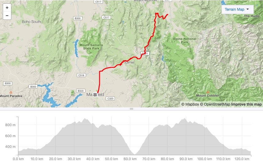
Mansfield to Whitfield return
Start/finish: Mansfield
Length: 125km
Terrain: Hilly
Strava: here
A tough, undulating ride with two main climbs: the 8.5km ascent to Tolmie on the way out, and the 10km climb straight out of Whitfield to begin the way back. There are some great views available throughout — particularly near Whitfield — and the 4km detour to Powers Lookout (unsealed), provides sensational views over the nearby King Valley.
ADVERTISEMENT
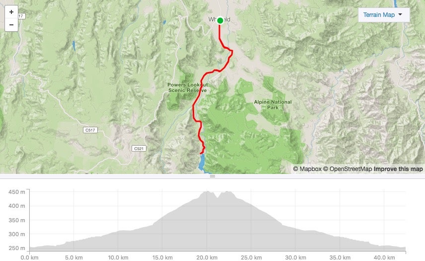
Whitfield to Lake William Hovell, return
Start/finish: Whitfield
Length: 42.5km
Terrain: Slightly hilly
Strava: here
A lovely little jaunt through the King Valley wine region. Lake William Hovell is perfect for a swim on a warm summer’s day, while the many wineries in Whitfield are the perfect reward for completing this ride. Slightly uphill on the way there, slightly downhill on the way back. Known locally as the Cheshunt Cruise.
ADVERTISEMENT
Myrtleford to Lake Buffalo, return
Start/finish: Myrtleford
Length: 42km
Terrain: Undulating
Strava: here
Another scenic ride with a swimmable lake at the halfway point. This quiet ride down the Buffalo River Road sees you sweep around the back of Mt. Buffalo on a beautiful rolling country road.
ADVERTISEMENT
Omeo to Anglers Rest
Start/finish: Omeo
Length: 57km
Terrain: Hilly
Strava: here
This stunning section of road is part of the Peaks Challenge loop but more than worth visiting on its own. The Omeo Highway (a quiet one-lane road) winds its way alongside Big River, offering one of the most picturesque rides in the region. Have a bite to eat at the Blue Duck Inn before turning around, or continue on towards the Back of Falls climb. In fact, the Omeo Highway continues for roughly 100 stunning kilometres as it heads north towards the Victoria-New South Wales border. A beautiful stretch of road.
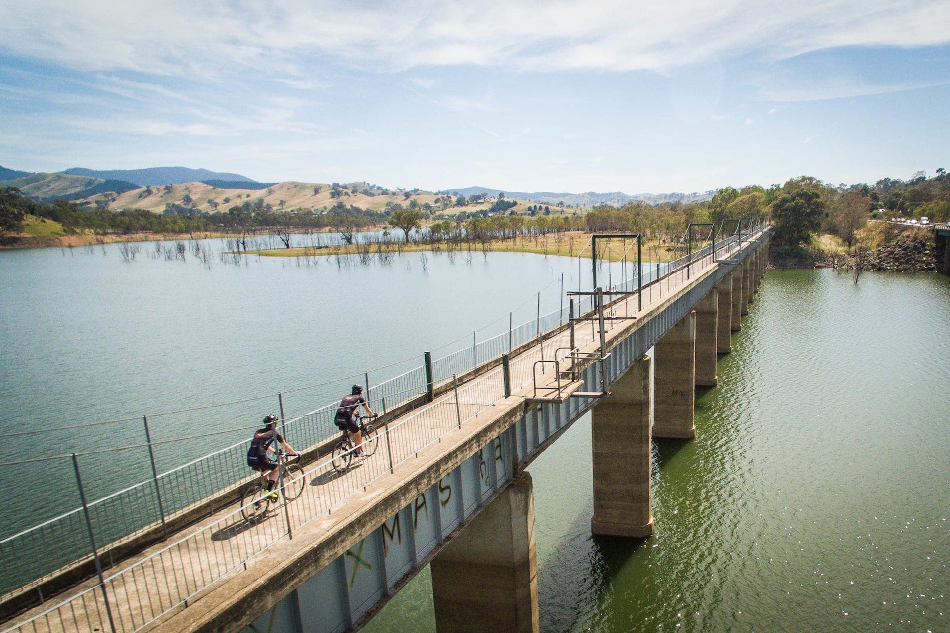
Back in the heyday of Victorian rail, the southern state was criss-crossed by a myriad of train networks. Most of those lines have since been abandoned, a development which has benefited the cycling community greatly. Around the state, many disused rail corridors have been turned into rail trails, providing the perfect way for cyclists of all abilities to get safely from town to town. Several of these rail trails, forming a network of more than 300km, can be found in the High Country.

Great Victorian Rail Trail
Start: Tallarook
Finish: Mansfield (plus Alexandra)
Length: 125km (main arm)
The main arm of the Great Victorian Rail Trail runs from Tallarook (near Seymour, a stop on the Melbourne to Sydney rail line) all the way to Mansfield, more than 120km to the east. There’s also a 15km arm of the trail that runs from Cathkin (roughly halfway between Tallarook and Mansfield) to Alexandra, making the Great Victorian Rail Trail the longest in the country.
As you’d expect from a rail trail, the Great Victorian Rail Trail is largely flat. But there is the odd section of gradual climbing to contend with around Cheviot and from Cathkin as you make your way towards Mansfield.
Note that the Great Victorian Rail Trail is unsealed in parts, but it’s more than rideable on regular road tyres.
Find out more here.
ADVERTISEMENT
Murray to Mountains Rail Trail
Start: Wangaratta
Finish: Bright (plus Beechworth and Milawa)
Length: 85km (main arm)
The main arm of the Murray to Mountains Rail Trail runs alongside the Great Alpine Road, the main touring route between Wangaratta and Bright (and beyond to Wandiligong). It’s a mostly flat track with the odd climb in it, but one that’s suitable for riders of all ages (particularly near Wangaratta and near Bright).
Besides the main arm, the Murray to Mountains Rail Trail also branches off just past the old Everton station and heads up towards Beechworth. And it is up — it’s mostly uphill to to the famous gold rush town and a challenging ride. There’s also a branch that takes you down towards Milawa.
With a total length of 116km, the Murray to Mountains is the longest sealed rail trail in the country.
Find out more here.
Here’s some advice for riders that are venturing out into Victoria’s High Country, a beautiful region but one that demands respect:
- Be sure to pay attention to the weather forecast. The weather in Victoria’s High Country is quite variable and can change quickly. It might be 25ºC and sunny in the valley but close to freezing at the top of the mountains. Know what you’re in for and prepare accordingly.
- Always bring a rain jacket with you. Even if it doesn’t look like you’ll come across any rain, always stick a jacket in your back pocket. As mentioned, conditions can change rapidly in the High Country — particularly at the top of the mountains — and you’ll be grateful if bad weather does set in.
- Fill up your bidons and take enough food. Depending on where you are riding, it can sometimes be many kilometres between towns in the High Country. Again, prepare accordingly, and make sure you’ve got what you need.
- Don’t always count on having phone reception. Some areas of the High Country are very remote and won’t have mobile phone signal (near Mitta Mitta, for example). Don’t count on being able to make a phone call if you need to — be as self-sufficient as you possibly can.


Bright
Porepunkah
Mount Beauty
Beechworth
Yackandandah
Myrtleford
Milawa
Whitfield
Wangaratta
Mansfield
Whether you’re the sort of rider that wants to stay in an upmarket bed-and-breakfast or a tent in a riverside campground, you’ll be able to find something to your liking in Victoria’s High Country.
In many ways the town of Bright is the spiritual heart of the High Country, particularly if you’re in the region to climb mountains. With Mt. Buffalo, Falls Creek and Mt. Hotham all within riding distance, Bright is the perfect launching pad. The nearby towns of Porepunkah, Wandiligong, Germantown, Smoko, and Freeburgh and Mount Beauty also offer easy access to the mountains.
If you want to be even closer to the mountains, why not consider staying at one of the alpine resorts? Mt. Hotham, Dinner Plain, Falls Creek and Mt. Buller all have accomodation available in the “green season” and can provide a great base, particularly if you’re into mountain biking …
If you’re more interested in experiencing the region’s gold rush history, a little bit off the beaten track, the towns of Beechworth, Yackandandah, Myrtleford and Stanley are all worth a look. If you want great food and wine on your doorstep, check out Milawa, Everton, Oxley and Gapsted, and even the regional centre of Wangaratta.
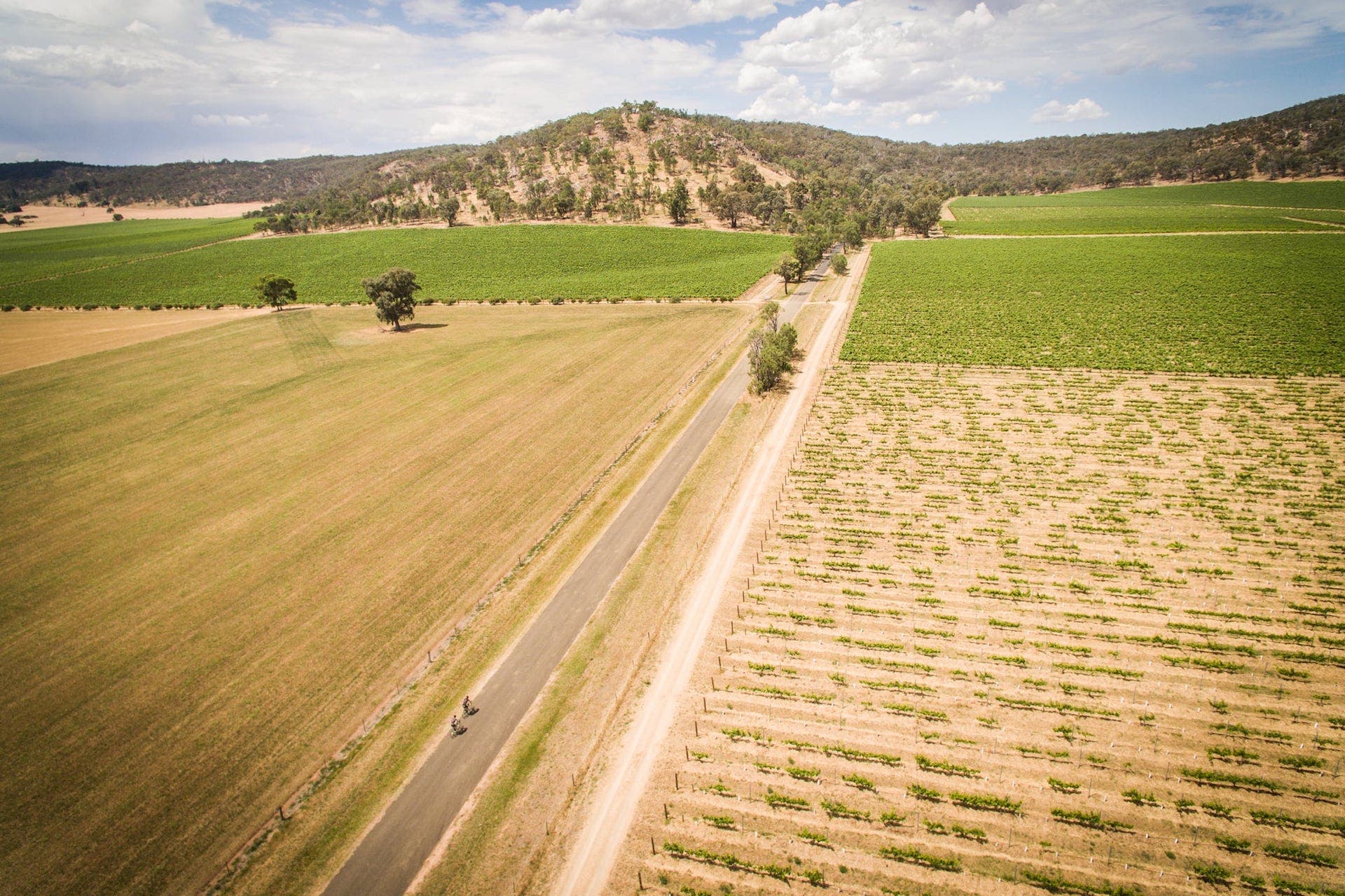
The King Valley is another foodie hotspot with great riding in the vicinity as well. Whitfield is the main town in the area and a great base if you want lovely rides and easy access to wineries and terrific local produce. Further south, the towns of Mansfield, Tolmie, Mirimbah and Merrijig give you easy access to Mt. Buller, while Mansfield is also connected to the Great Victorian Rail Trail.
In addition to the wealth of more traditional accommodation options available in the region, from hotels to serviced apartments and beyond, it’s worth remembering that we live in an age of sharing economy – so don’t forget to check AirBnB (where our Beechworth accommodation, One on Last, was listed) and the accommodation service Bright Escapes.
For more information about accommodation in Victoria’s High Country, and to book your stay, check out the region’s webpage.
Victoria’s High Country is a region famed for its great food and drink. As a result, there are many terrific cafes, restaurants, wineries and micro-breweries to stop at or to visit at the end of a long day on the bike.
Here are some of the places we ate and drank on our trip and that we would recommend.
Mansfield Regional Produce Store (Mansfield)
Known to locals simply as The Produce Store, this cafe/restaurant is on the main street in Mansfield and does a great lunch. Worth stopping in on your way through.
http://theproducestore.com.au/
Pizzini Wines / Mountain View Hotel (Whitfield)
The Pizzini family owns both a winery bearing its name and the local watering hole/accommodation provider in Whitfield. The winery specialises in Italian varieties such as Pinot Grigio, Arneis, Prosecco, Sangiovese and Nebbiolo while the hotel does great meals and has a selection of local beers on tap.
https://www.pizzini.com.au/pizzini/ / http://www.mvhotel.com.au/mountain-view/
Coffee Chakra (Myrtleford)
This cafe in Myrtleford does terrific coffee and a stellar breakfast. The food (they also do lunch) has an Indian twist to it, giving the place a unique feel in the Alpine Valley.
http://www.visitmyrtlefordvic.com.au/listing/coffee-chakra-myrtleford/
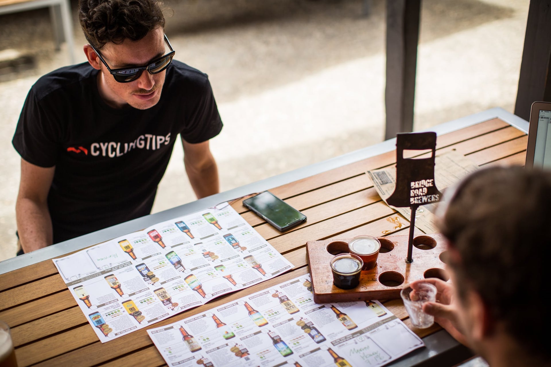
Bridge Road Brewers (Beechworth)
If you’re a beer lover, no visit to Beechworth is complete without a stop at Bridge Road Brewers. Started in 2005, Bridge Road has quickly become one of Australia’s most well-known and well-loved craft breweries. We’d recommend a tasting paddle and a pizza.
https://bridgeroadbrewers.com.au/
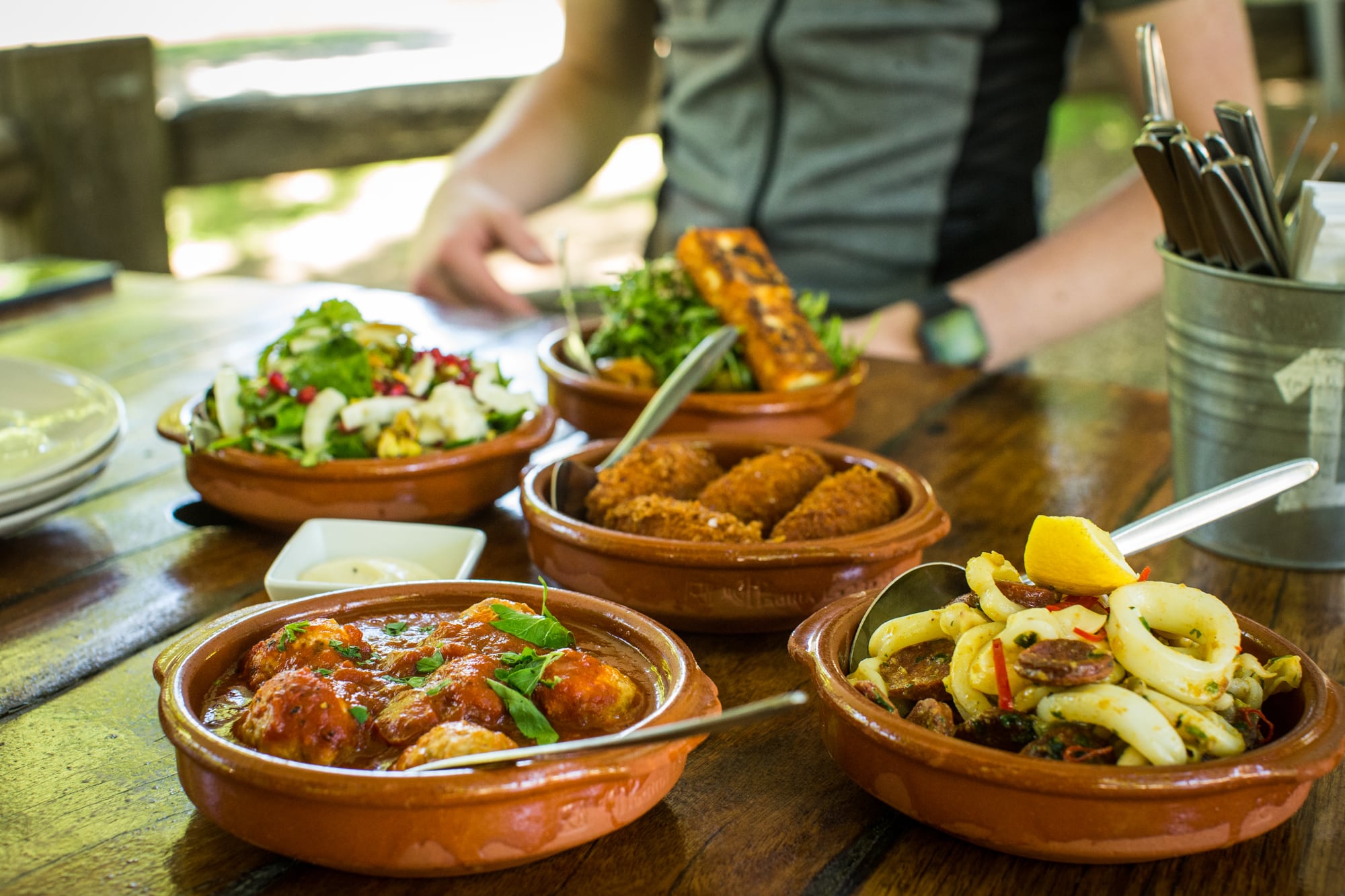
Ginger Baker (Bright)
This beautiful cafe/restaurant sits in the heart of town and offers outdoor seating right alongside the Ovens River. The tapas-style dishes are a highlight — be sure to get a few so you can sample the best local produce the region has to offer.
http://www.gingerbaker.com.au/
Bright Brewery (Bright)
This brewery also backs on to the Ovens River and makes the perfect venue for a post-ride beverage and meal. Best of all, the team at the brewery are big fans of cycling (they’re the title sponsor of the Tour of Bright) so cyclists are always welcome.
Saint Monday (Yackandandah)
Set in the main street of beautiful Yackandandah, this cafe has a seasonal menu that is underpinned by strong ethical values. Be sure to check out the terrific donuts and the homebrewed kombucha.
http://www.saintmondaycafe.com.au/
Star Hotel (Yackandandah)
Serving a selection of house-smoked meats and locally brewed Two Pot beer, the Star Hotel is an old pub with a new lease of life since its new owners renovated the restaurant and beer garden, and established a delicious Southern US fusion menu.
https://www.starhotelyack.com.au/
Malt Shed Brewery (Wangaratta)
A relative newcomer to the craft-brewing scene, the Malt Shed Brewery was founded in 2014. Besides their own ever-changing selection of beers on tap, the Malt Shed also features a range of beers from the region. Worth a look.
http://maltshedbrewery.com.au/
Stingray (Falls Creek)
Having earned a good feed with your ascent of Falls Creek, Stingray is a great mountain-top option. Offering a selection of burgers and tasty salads, they also do a decent coffee and by night transform into one of the more sophisticated bars on the mountain.
ADVERTISEMENT
https://www.qthotelsandresorts.com/falls-creek/eat-drink/stingray/